top of page
NAVTOR logo
shutterstock_2086791097 (1).jpg
NAVTOR-AMVER reporting.avif

Fully integrated, and automated as standard when used with Passage Planning.
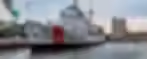
AMVER REPORTING

AMVER - Simply saving lives

NAVTOR has in cooperation with United States Coast Guard (USCG) integrated AMVER reporting into the NavStation. The result is a simplification of a crucial life-saving initiative; negating barriers to entry, easing administration and boosting a key support network for sailors worldwide. 

Responsible, compliant, and environmentally friendly shipping has never been more important. For society, for the world and for business well-being. With NAVTOR’s Environmental Regulations module, the very latest environmental data is layered on top of ENCs, giving you and your vessels a complete overview of what regulations apply when and where.

compass-reflected_edited.png
uscg-logo.avif
AMVER-flag.avif

A constantly evolving safety net for ships in distress

With AMVER Reporting Module you can:

  • Require Passage Plan module and NavBox with Position Input

  • Send a Sailing Plan (SP) based on an Approved Passage Plan

  • Will also be activated as a passage in NavFleet

  • Send Position Reports (PR) manually or automatically with user-defined frequency

  • Send a Deviation Report (DR) by updating with new Passage Plan 

  • Send a Final Report (FR) when completing a passage

Todd Allen - 2022_edited.avif

Article:

Simplifying saving lives: automating AMVER

NAVTOR has teamed up with the United States Coast Guard (USCG) to integrate AMVER into the upcoming release of the digital chart table software NavStation. The result is a simplification of a crucial life-saving initiative; negating barriers to entry, easing administration and boosting a key support network for sailors worldwide.

Read more in article

Discover more layers and modules in NavStation

Maritime Security Information

Maritime Security Information

Stay alert and informed regarding the global threat landscape with comprehensive intelligence data powered by Risk Intelligence.

Auto Routeing monitor

Auto Routeing

Simply plan your voyage from any position to any position, globally.

Data Layers monitor

Data Layers

Paperless and easy access to Time Zones • Load Lines • Chart 1

Port Data monitor

Port Data

Powered by S&P Global

Extended Port Database - Providing you with the most comprehensive port directory.

AMVER Reporting

AMVER Reporting

Simply saving lives!

NAVTOR has teamed up with the United States Coast Guard (USCG) to integrate AMVER into the NavStation.

User layers monitor

User Layers

Add your own icons on top of

any layer in NavStation.

Weather Routeting monitor

Weather Routeing

Powered by WNI

Leading the way in weather. High-quality data and best-in-class ship routeing visualisation and optimisation with WNI and NavStation’s unique planning capabilities.

Manoeuvring Assistand

Manoeuvring Assistant

Find your way through heavy traffic and complex berthing operations with NAVTOR’s unique Manoeuvring Assistant module.

Passage Planning

Passage Planning

Our award-winning Passage Planning module transforms administration for bridge officers, automating processes, easing workloads and opening up a new age of efficiency, safety and simplicity.

Environmental Regulations monitor

Environmental Regulations

Complete Compliance

With environmental regulations increasing in stringency and complexity, access to the right data, at the right time, protects you from paying the price of non-compliance.

NAVAREA Warnings

NAVAREA Warnings

Global coverage of NAVAREA Warning (world-wide service) updated on a daily basis.

Wather Overlay monitor

Weather Overlay

NAVTOR has teamed up with Weathernews Inc (WNI) to deliver the market's most comprehensive, high quality and up to date weather data. 

e-Publication Reader monitor

e-Publication Reader

Read all about it.

Every maritime publication you need, just a few clicks away. NavStation's e-Publication Reader Module is a complete management tool – easy, compliant and always up to date.

AENP monitor

AENP

Seamlessly register, access, licence and update all AENPs from within the software.

ADP laptop

ADP

Displayed graphically over ENC data in their geographic location.

AIO monitor

AIO

ADMIRALTY Information Overlay - displayed over ENCs in ECDIS and other chart display systems for additional information during passage planning.

Route Planning monitor

Route Planning

Easy and enhanced route planning.

All the information you need available with module overlays. Easily import routes to and from ECDIS. 

ENC monitor

ENC

All the most trusted charts and publications for every conceivable voyage, delivered when and where you need them.

bottom of page