top of page
NAVTOR-logo-strapline-colour.png
NAVTOR_Timo-Essers_eNavigationDirector -3.2.jpg

"We handle the complexity, meaning you can breathe easy." 

Timo Essers, e-Navigation Director

NavStation logo-colour.png

Route planning to perfection

Simple, seamless and integrated - all the information you need to plan and execute an optimal vessel voyage, in one place, at your fingertips.

NavStation brings it all together – from Auto Routeing and real-time weather layers to Passage Planningregulations, reporting, and much more. A smart, connected platform that turns complex data into clear decisions – all in one seamless interface.

Everything you need to plan your voyage

One system, one platform. NavStation from NAVTOR provides access to a wide range of digital navigational information, seamlessly integrated as overlays on official ENC charts.

NavStation-illustration-july25.png
  • Monitor---NavStation-6-4-Maritime-Security-module.png

    Maritime Security Information

    Stay alert and informed regarding the global threat landscape with comprehensive intelligence data powered by Risk Intelligence.

  • Auto Routeing

    Simply plan your voyage from 
    any position to any position, globally.

  • NAVTOR-TimeZones.png

    Data Layers

    Paperless and easy access to

    Time Zones • Load Lines • Chart 1

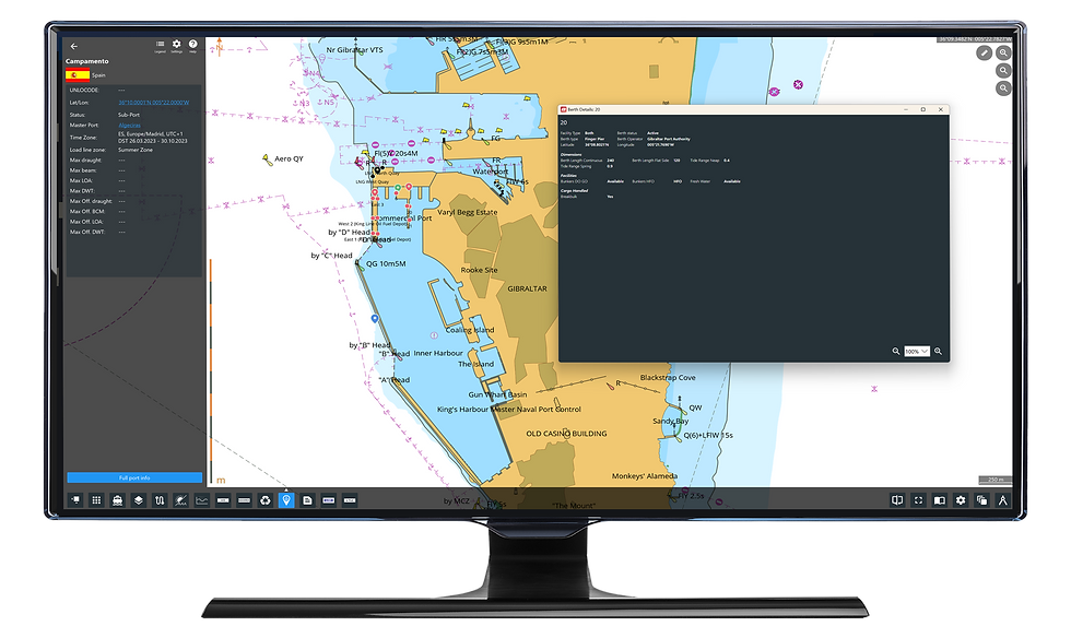
  • Port-Data-Gibraltar-.png

    Port Data

    Powered by S&P Global

    Extended Port Database - Providing you with the most comprehensive port directory.

  • 893d6f_05a295a4fa51453680334c6362153cc1~mv2.avif

    AMVER Reporting

    Simply saving lives!

    NAVTOR has teamed up with the United States Coast Guard (USCG) to integrate AMVER into the NavStation.

  • Userlayer-monitor-web.avif

    User Layers

    Add your own icons on top of

    any layer in NavStation

  • WNI-OSR-monitor- two-routes-web.avif

    Weather Routeing

    Powered by WNI

    Leading the way in weather. High-quality data and best-in-class ship routeing visualisation and optimisation with WNI and NavStation’s unique planning capabilities.

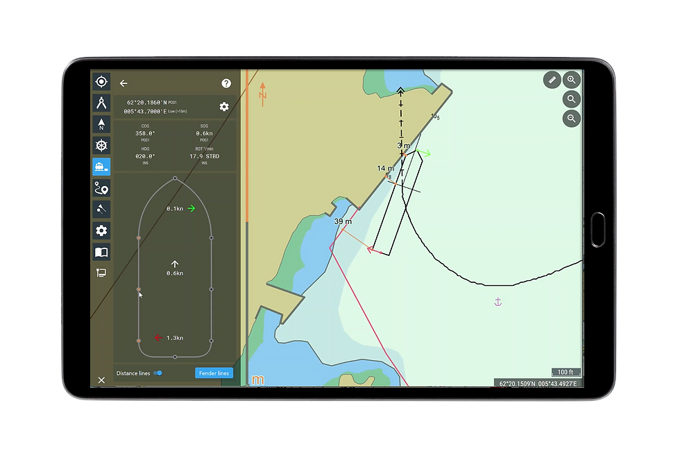
  • MA-docking copy.png

    Manoeuvring Assistant

    Find your way through heavy traffic and complex berthing operations with NAVTOR’s unique Manoeuvring Assistant module.

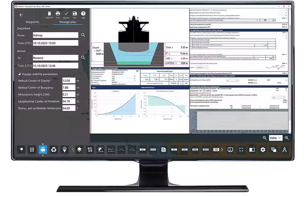
  • NavStation-Passage-plan_UKC_MONITOR.avif

    Passage Planning

    Our award-winning Passage Planning module transforms administration for bridge officers, automating processes, easing workloads and opening up a new age of efficiency, safety and simplicity.

  • EnvironmentalRegulations-monitor-web.avif

    Environmental Regulations

    Complete Compliance

    With environmental regulations increasing in stringency and complexity, access to the right data, at the right time, protects you from paying the price of non-compliance.

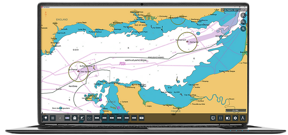
  • NAVAREA-laptop-web.png

    NAVAREA Warnings

    Global coverage of NAVAREA Warning (world-wide service) updated on a daily basis.

  • Weather Overlay WNI.avif

    Weather Overlay

    NAVTOR has teamed up with Weathernews Inc (WNI) to deliver the market's most comprehensive, high quality and up to date weather data. 

  • e-publication-reader.png

    e-Publication Reader

    Read all about it.

    Every maritime publication you need, just a few clicks away. NavStation's e-Publication Reader Module is a complete management tool – easy, compliant and always up to date.

  • AENP-laptop-web.png
    ADMIRALTY_AENP_STACK_RGB_NEG_BOX.avif

    AENP

    ADMIRALTY e-Nautical Publications.
    Seamlessly register, access, licence and update all AENPs from within the software. 

  • ADP-laptop-web.avif

    ADP

    ADMIRALTY Digital Publications.
    Displayed graphically over ENC data in their geographic location.

  • 2020-04-17 15_32_06-NavStation - AIO 2.avif

    AIO

    ADMIRALTY Information Overlay.
    Displayed over ENCs in ECDIS and other chart display systems for additional information during passage planning.

  • Route-planning-image.avif

    Route Planning

    Easy and enhanced route planning.

    All the information you need available with module overlays. Easily import routes to and from ECDIS. 

  • AVCS-ENC-laptop-web.png
    ADM_SERVICE_PROVIDER_RGB_COLOUR.png

    ENC

    All the most trusted charts and publications for every conceivable voyage, delivered when and where you need them.

  • 01- NavStation-wDesktop.avif

    NavStation Desktop

    All navigational information at one place.

    NavStation includes access to an array of digital navigational information incorporated additionally as overlays on top of official ENC charts. 

NavBox.png
cyber-secure-NavBox-hvit.png

Automatic and seamless updates with NavBox

Databases and permits are automatically distributed and updated seamlessly through our cyber-secure NavBox. Once the plan is complete, verified and approved routes are transferred to ECDIS at the front of the bridge and to shore (NavTracker/NavFleet).

The ultimate maritime route planning tool

Ranging from weather data to Environmental Regulations, Passage Planning modules, and much more – enabling greater insight, compliance, efficiency and decision making, both in terms of real-time operations and long-term strategy.

  • Seamlessly integrates the very latest critical voyage data​

  • Exchange routes with other vessels in the fleet and with the ship managers onshore​

  • An automatic Passage Planning module allows the navigator to effortlessly access and create required documentation while planning voyages​

  • Databases and permits are automatically distributed and updated seamlessly through our secure NavBox  ​

  • Plan and continually optimise safe, secure and economical voyages​

  • Reduce workload and risk of human error.

NavStation is compatible with any standard PC and monitor, including touch screen devices. It is comprehensive, intuitive – with navigators simply grabbing, swiping and manoeuvring layers according to needs.

NavStation-isolated-PP-OHC.png
compass-reflected_edited.png
Monitor---NavStation-6-4-Maritime-Security-module-NewRelease.png
NavStation_edited.png

New version out now!

This release brings a suite of new features that support efficient voyage planning and greater onboard situational awareness. Further strengthening our commitment to customers by developing smart digital solutions that make life easier for shipping companies and shape the future of Maritime Operations.

Discover the new NavStation 6.4 features: 

  • NEW MODULE! – Maritime Security Information

  • Multiple port Passage Planning

  • Environmental Regulations layer updates

  • Voyage debriefing form access

  • Manouevring Assistant offers full user chart access

  • Extended port information with ADP & berth statistics 

  • Import & Export JRC ECDIS layers

Upgrade to NavStation 6.4:

The NAVTOR account manager will contact your organisation to initiate the upgrade process for your vessel.

Not NAVTOR customer yet? Request a demo or contact us today!

893d6f_a664cdd83e4a4659bf3e4194d9e9078d~mv2.avif

NavStation Webinars 

893d6f_4ff3a10e4748476da4884b4cd9acdf9a~mv2.avif

Unlocking smart shipping

893d6f_4bd10c6f060d452fa89f5b19f98e45ff~mv2.avif

Why NAVTOR
 

During familiarization with the NavStation, we liked it from the beginning. It is very simple and easy to use. What we really liked the most is the NAVAREA warnings plotted on top of ENC where you can see right away which warning affects our route. 

Second Officer / SBI VIRGO

NavBox logo-white.png

Full potential with NavStation

NavBox is the centre of our e-Navigation ecosystem – connecting vessels, fleets and facilities, with simple, secure and seamless transferral of the very latest navigational data.

NavBox.png

Discover NAVTOR's integrated solutions

NavStation NAVTOR
NAVTOR-product-logos5.png
  • The optimal route planning tool.

  • Integrates all navigational data into one screen.

  • Voyage optimization.

Navtracker-NewApp.png
NAVTOR-product-logos6.png
  • Calculate and control costs.

  • Keep track and estimate chart usage.

  • Update and reports.

NavFleet-monitor-2-web.avif
NAVTOR-product-logos4.png
  • Improve vessel performance.

  • Enhance better decision-making.

  • One integrated solution for planning, execution and compliance.

NavTV-monitor-isolated-web.avif
NAVTOR-product-logos7.png
  • Real-time feed of your fleet’s movement.

  • Insights into vessel speed, course, and destination.

NavBox.png
NAVTOR-product-logos2.png
  • Installs as software or hardware.

  • Automatic download of new navigational data.

  • Full seamless ENC distribution.

DigitalLogbooks-monitor-release-2_4.avif
NAVTOR-product-logos.png
  • Compliant with all relevant IMO guidelines.

  • A class and flag state approved solution.

  • Customised to vessel configurations.

bottom of page