

MONITORING
The simple solution for monitoring fleets operation
NavFleet is the perfect solution if you require a tool to track and monitor your vessel activities, empowering shore users with operational insight, and situational awareness ensuring safe and reliable vessel operation.
The Monitoring subscription level
in NavFleet:
The Monitoring level is the base subscription level in NavFleet.
Get added insight and better situational awareness with the complete solution for monitoring vessel and fleet operations.
Explore the three main subscription levels of operational insight.

Monitoring features in NavFleet:

Digital Logbooks
Easily Track & analyse logbook data from anywhere. Can be exported as pdf.

Voyage Tracking
Gain real-time visibility into vessel movement and optimize routes.

Voyage Monitoring
Plan voyages efficiently, monitor progress and receive alerts.

Speed Tracking
Improve efficiency by monitoring vessel speed and weather conditions.

Weather Layers
Anticipate and plan for adverse
weather conditions.

Port information
Access crucial details about over 11000 ports, including weather, country, flag, UN/LOCODE, and more.

Event log
Get situational awareness across your onshore team with shared view of fleet operations.

Advanced Notifications
Customize alerts and ensure your team stays informed.
Get user-specific notifications in the system or via email covering several different events, such as vessel schedule, off-track, speed limits and bad weather ahead.

Time Zone Layer
Get the full overview with the map overlay showing time zones.

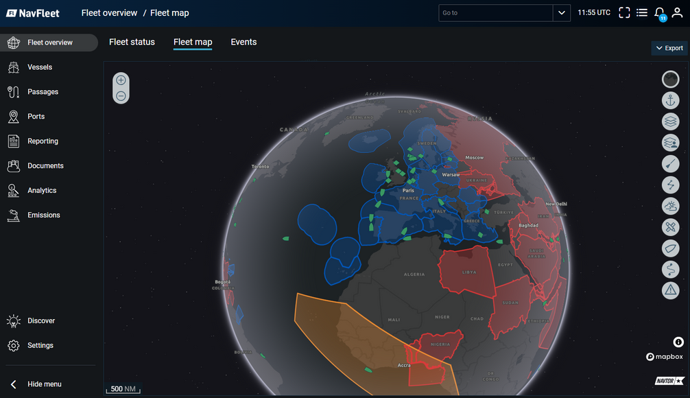
3D globe map viewer
Option to view the map on a 3D globe. Show day/night. Option to enable tilt.

Safe Navigation
Ensure vessels adhere to approved passage plans for safe navigation.

Area Insight Report
View time and distance spent in designated areas such as Domestic ECA, ECA, EU zones, and other regions, available for individual vessels and entire fleets.
The Monitoring features in NavFleet are ideal for both with and without a passage plan. For added situational awareness, see NavStation Passage Plan.
NavFleet version 2.4
Monitoring module updates:
-
3D Vessel icons added with CCRP values and headings to display the vessel model on the map.
-
Added 7,000 ports, searchable by country, port name, and UN/LOCODE.
For NavFleet users, to access the latest features, please log out and log back in, then refresh your NavFleet Portal.
Not a NavFleet user yet?
Request a demo for a free trial, or contact us today.
ENC Online by NAVTOR
The ENC Online by NAVTOR module is available in the NavFleet Monitor module.
This is a cost-effective Online ENC layer for onshore teams in maritime operations. Empower your onshore offices with seamless access to official electronic navigational charts directly in their browsers, eliminating the need for costly ENC cells intended for onboard usage.


Safe, smart, and sustainable
shipping operations
Everything you need in one easy application. NavFleet connects ship and shore with seamless sharing of information, such as passage plans, routes, layers, documents, and certificates between platforms. Enhance operational performance with instant insights into GHG intensity for the vessel and fleet, ensure high quality data through dual-layer validation in system checks, and streamline environmental compliance by automating emission reporting and data feed to verifiers.
Focus on flexibility
Our modular approach makes it easy to configure your ideal solution.
Explore the three main subscription levels of operational insight and choose the option that is best for you:


